
GEUS receives major grant to study the dynamics of the upper spongy layer of the Greenland Ice Sheet

Published 02-09-2026

The upper layer of the Greenland Ice Sheet is called firn and functions somewhat like a large sponge. This ‘sponge’ may have a crucial impact on how much sea levels will rise in the near future – but there is not much knowledge about the interaction between the firn layer and meltwater from the surface. A new ERC project is set to change that.

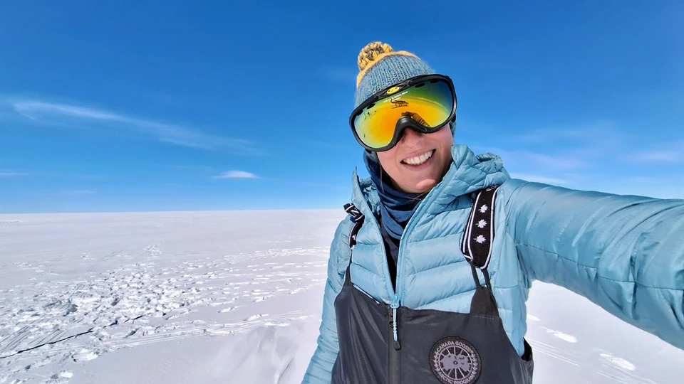
Senior researcher Anja Rutishauser has many years of experience with fieldwork on the Greenland Ice Sheet. Photo: Private

With a European Research Council (ERC) Starting Grant of DKK 13 million behind her, senior researcher Anja Rutishauser from the Department of Glaciology and Climate at GEUS can now launch the project Beyond the Column: Greenland Firn in 3D – FIRN3D.

In her own words, it is a dream project, in which she will spend a five-year period investigating the dynamics and physics of the interaction between meltwater and the upper layer of the Greenland Ice Sheet known as firn.

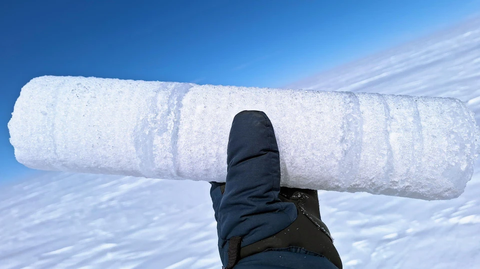
Firn is compacted snow with countless air pockets. The layer is a transition zone between snow and ice and can be up to 100 metres thick. Due to the many air pockets, the layer functions somewhat like a sponge, absorbing a large proportion of the meltwater from the surface, after which some of it refreezes.
Losing storage capacity

However, we still know very little about what is happening inside this sponge. How does meltwater move through the firn? How deep does it penetrate? Where and how much of the meltwater refreezes, and how much continues to flow and runs off the ice sheet?

“It is incredibly important to know more about the interaction between meltwater and firn layers, because it has a major impact on how the firn will develop in the future, and how much meltwater from the ice sheet will reach the sea and contribute to sea-level rise,” explains Anja Rutishauser.

Just as a sponge can become saturated, there is also a limit to how much meltwater the air pockets in the firn can store. As global warming progresses, the firn is losing its internal storage capacity, as the increasing amount of meltwater each year means that an ever larger proportion of the air pockets become filled.

In addition, thick layers of ice form, which block the meltwater from penetrating further down into the deeper air pockets in the firn and making use of the storage capacity there.

These factors constitute a crucial tipping point, which could lead to a considerable increase in Greenland’s contribution to sea-level rise.

The upper layer of the Greenland Ice Sheet consists of firn, which is compacted snow with a whole lot of small air pockets. Photo: Anja Rutishauser

Building a completely new instrument

To learn more about the interaction between firn and meltwater, Anja Rutishauser and her upcoming project team will use the method of radar tomography across boreholes, which is often used in hydrological research. But it requires more than a standard instrument to carry out this type of measurement in firn – a material that is fundamentally different from, for example, soil and rock – and under the harsh conditions in Greenland. At the same time, the system must be able to operate autonomously. Therefore, the researchers need to develop a specially designed system that can stand at selected locations on the Greenland Ice Sheet and carry out autonomous measurements throughout an entire year.

The instrument will make it possible to create 3D images of the movement and flow of meltwater through the firn on the Greenland Ice Sheet. In addition, the researchers will use firn cores to measure the density and stratigraphy of the firn, i.e. grain size and the existing ice layers.

Combined with other data from the Greenland Ice Sheet, including air temperature, solar radiation and wind speed, the researchers will thereby obtain a much better picture of what happens to the meltwater within the firn itself.

Instrument helps distinguish firn from melt water

The instrument will consist of six tubes drilled down into the ice. Each tube will have a series of small transmitters and receivers attached to it, which are timed to emit and receive electromagnetic signals in the form of radar waves. Depending on which material the radar waves encounter – in this case firn and meltwater, respectively – they produce different signals that can be converted into 2D images. Many 2D images can together form 3D images, which can ultimately be interpreted by the researchers. In this way, they can distinguish firn from meltwater and learn more about the interaction.

A better understanding

Ultimately, the 3D radar images will form part of a 3D model of meltwater flow.

“Right now, we have no 3D time series of observations of this interaction, so we are basically blind to the processes taking place. With FIRN3D, we want to achieve a better understanding of the physical processes that govern the interaction between firn and meltwater, and then find a way to represent these processes in large-scale firn models, which are used to predict the future mass balance of the ice sheet and the runoff of meltwater,” says Anja Rutishauser.

The current firn models use very simplified descriptions of the processes in the firn layer. This creates considerable uncertainty in predictions of future changes in the firn, meltwater runoff and the ice sheet’s mass balance.

Important synergy between firn projects

The project is scheduled to start in the summer of 2027, and once the radar instruments are ready, they will be installed at two different locations on the Greenland Ice Sheet. There, they will operate independently and collect data every 20 minutes throughout the year.

The results from FIRN3D go hand in hand with FirnMelt, another major firn project. Here, researchers from GEUS, including Anja Rutishauser, are collaborating with researchers from three European universities. While FIRN3D investigates how meltwater moves through the firn at the process scale, FirnMelt quantifies how the firn layer changes at a large scale and projects its development all the way to the year 2300.

FIRN3D will investigate the firn layer using specially developed instruments, which will be placed at two different locations on the Greenland Ice Sheet (red dots). The blue areas mark the ice sheet’s ablation area. Figure: Anja Rutishauser
Anja Rutishauser
Senior Researcher
Glaciology and Climate
Fie Krøyer Dahl
Editor
Press and Communication